Vintage 1920s Yolo Basin Causeway Postcard: Sacramento to Davis
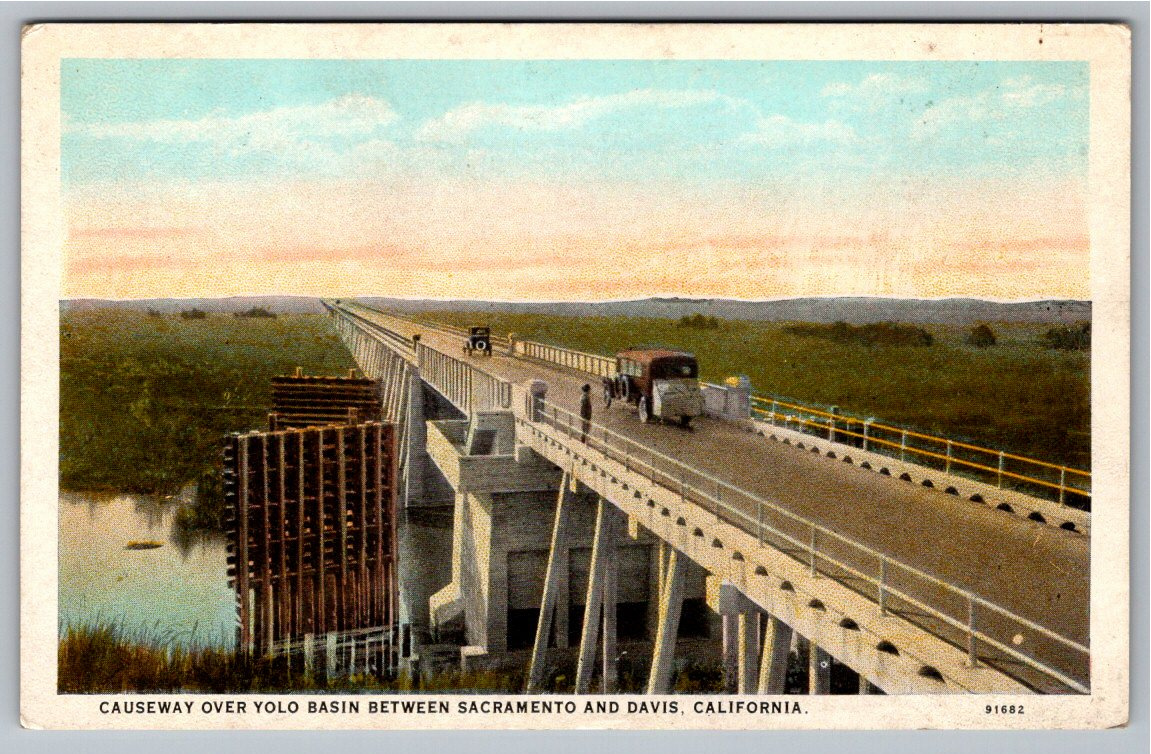
📸 Click any thumbnail to inspect Front, Back & Angles (2 Photos)
As an eBay Partner, we may earn a commission if you make a purchase.
Item Specifications
- Era: 1920s White Border
- Publisher: Curt Teich / Frank McDougal
- Location: Yolo Basin, California
- Subject: Yolo Causeway Bridge & Early Automobiles
- Originality: Original Vintage Postcard
- Condition: Pre-Owned Vintage
- Category: Postcards & Ephemera
- Format / Type: Vintage Postcards
Looking for Modern Alternatives?
Explore top-rated, modern Postcards & Ephemera and related historical accessories on Amazon.
Shop Postcards & Ephemera on Amazon →As an Amazon Associate, we earn from qualifying purchases.
Historical Context & Overview
Engineering the Golden State: The Great Yolo Basin Causeway
In the early twentieth century, traveling between California's state capital of Sacramento and the agricultural communities of Davis and the San Francisco Bay Area was a formidable challenge. Every winter and spring, seasonal run-off flooded the sprawling Yolo Basin—a massive low-lying marsh extending over 120 miles through the Sacramento Valley. For up to eight months each year, overland vehicular transit was virtually impossible, forcing drivers onto a muddy, notoriously unreliable dirt route known locally as the "Tule Jake" road. That isolation ended in 1916 with the opening of the Yolo Basin Causeway, an engineering marvel celebrated as one of the longest concrete trestle bridges in the world at the time.
This striking original 1920s white-border postcard captures the causeway during the dawn of American motoring. The image showcases early vintage automobiles traversing the narrow, elevated roadway while marshy tule reed waters extend across the horizon. Visible adjacent to the main concrete structure are heavy timber pilings and support frameworks, illustrating the ongoing maintenance and expanding infrastructure required to keep California's growing fleet of automobiles moving year-round.
The Gateway for Early Northern California Motoring
The completion of the three-mile causeway revolutionized commerce and tourism across Northern California. By connecting the east and west sides of the Sacramento Valley, the bridge formed a vital link along the Lincoln Highway—America's first transcontinental automobile route—and later US Route 40. Motorists in Model Ts and early enclosed sedans could finally cross the vast floodplain in minutes rather than facing hours of perilous travel or waiting for summer heat to dry out the basin bottom.
For modern collectors of transportation history, images of the original Yolo Causeway offer a direct window into the rapid modernization of Northern California. The stretch represented a monumental shift from horse-drawn transport and riverboats toward a state defined by highway infrastructure, long-distance motoring, and automobile culture.
Production and Publisher Details
This fine piece of ephemera was produced using the signature "C.T. American Art Colored" process by the renowned Curt Teich Company of Chicago, Illinois, and distributed locally by Sacramento publisher Frank McDougal. The back features informative printed text explaining how the trestle united the Sacramento Valley and eliminated the seasonal isolation of the Capitol City. Preserved in unposted condition with a clean split-back layout, this card remains an exceptional keepsake for historians of early California infrastructure, vintage automobile enthusiasts, and postcard collectors alike.